1860s Belfast map showing urban development by May in yellow, the grid anchored on Cromac Street in red with Cromac Street in red, Victoria Street in blue and the Long Bank in green
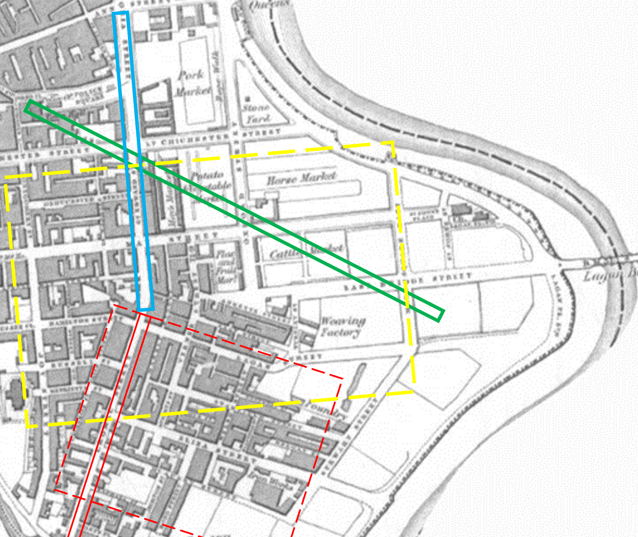
(1860s Belfast map showing urban development by May in yellow, the grid anchored on Cromac Street in red with Cromac Street in red, Victoria Street in blue and the Long Bank in green)